Raster
- Mapbox Glossary
- Raster data is a pixel-based data format that efficiently represent continuous surfaces. Information in a raster is stored in a grid structure with each unit of information, or pixel, having the same size and shape, but varying in value. All digital photographs are stored in this format, which is also referred to as a bitmap. This includes satellite images and orthophotography.
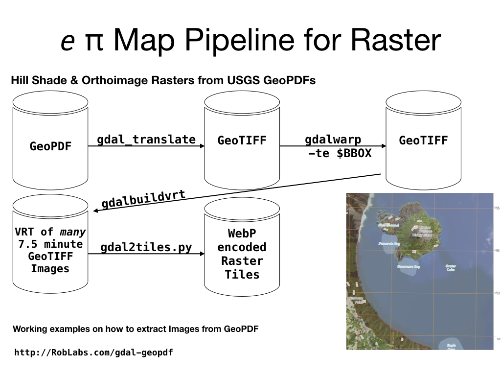
Working examples on how to extract Images from GeoPDF
https://RobLabs.com/gdal-geopdf